Main Info
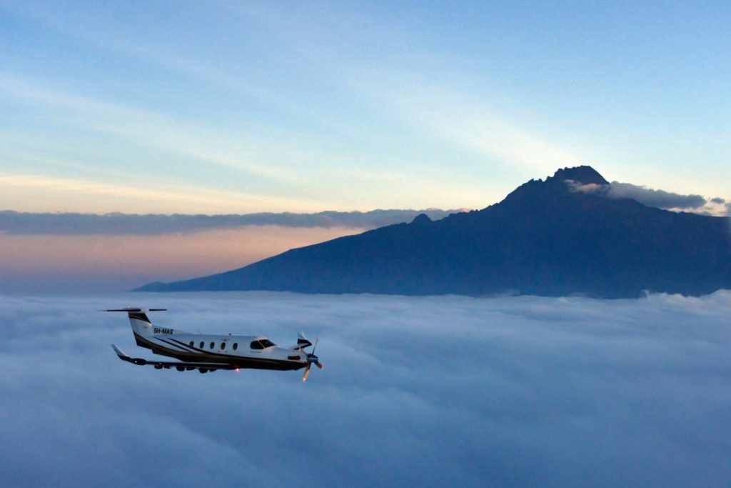
In what may undeniably be attributed to as the highest and arguably the most scenic flight in Africa, views from above the world’s tallest freestanding volcanic mass are set to leave you stupefied.
At a fraction of the cost, time and energy spent in scaling this African giant on foot, our scenic flight of Mount Kilimanjaro presents you with a unique metamorphic experience that will by far surpass any other way of encountering this ideal destination.
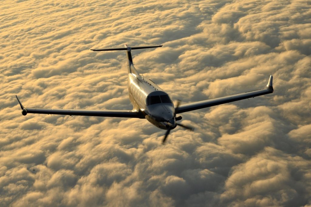
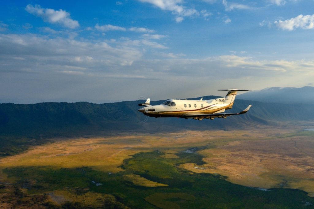
We begin our scenic flight on board our comfortable pressurized Swiss-made turboprop PC12 aircraft as we get airborne from Arusha Airport flying over the Arusha CBD on a North-East bearing towards Kilimanjaro with views of the Mount Meru to our left. En-route we shall fly over the Arusha National Park, slice in between the Ngurdoto crater and the Momela lakes, onto West Kilimanjaro and get into the Mount Kilimanjaro National Park zone. We then gain altitude as we fly over the Shira plateau and eventually settling at a maximum cruising altitude of 21,000ft for the vantage views of the Kilimanjaro glaciers, Mawenzi peak and finally circumvent the Kibo peak, Africa’s highest peak and the epitome of the flight before descending back to Arusha.
Scenic Highlights
- Mount Meru
- Arusha City
- Arusha National park
- Ngurdoto Crater
- Momella lakes
- Mount Kilimanjaro national park
- Shira Plateau
- Mawenzi peak
- Kibo peak and Kilimanjaro glaciers
Terms and Conditions
- Only 1 piece of luggage (10kg / 22lbs) and 1 hand luggage (5kg / 11lbs) per person allowed on board.
- For safety purposes, all scenic flights will be operated subject to prevailing weather conditions.
- Flight paths may vary due to weather and are at the pilot’s discretion.
- Nisimulie Africa reserves the right to alter prices, departure times / dates, and flight routes or arrange alternative aircraft services.
- All flights require a minimum of 8 people. Bookings will be accepted for numbers less than the required minimum number on the basis that bookings will be coordinated to achieve minimum numbers. Alternatively you can charter away the entire aircraft for an exclusive experience.
- Any booking that is cancelled or amended within 48 hours of departure will be charged in full
- Bookings that are cancelled or amended outside of 48 hours prior to departure can be done so at no charge.
- Clients wanting to make changes are required to contact Nisimulie Africa reservations by 1800hrs EAT prior to departure.
Itinerary
The Arusha airport (Elevation - 4567ft above sea level) was initially developed by Colonel Grey in 1956, a large-scale coffee and sorghum farmer in the neighboring areas of Burka and Mateves, before being handed over to the government after the independence of Tanganyika from the Colonial rule in 1961.
Today Arusha Airport, managed under the Tanzania Airports Authority, is one of the busiest airports in Tanzania owed to the huge tourist traffic commuting between the tourist hub of Arusha and other popular destinations of Tanzania including Serengeti, Ngorongoro to the North, Mahale and Katavi to the west, Selous game reserve and Ruaha to the south and Zanzibar and Dar es salaam to the east.
Documented settlement within the current Arusha city is placed at around the 1830’s initiated by the Wa-arusha, an agro-pastoral sub-tribe of the pastoralist Maasai Community. Arusha came under the German and British colonial rule from 1896 – 1961 with keen interest from her colonial masters in the area due to it’s fertile lands, favorable climatic conditions and geographical setting making the city a significant historical center within Tanzania.
Today, Arusha is a metropolitan city with an estimated population of 1.6 million people. Thanks to improved infrastructure, policies and government support, Arusha is experiencing a booming economic growth mainly from the tourism, mining and agricultural sectors. Arusha is home to one of the rarest gemstones in the world, Tanzanite, which is only found and mined within the Mererani area. Over the years, Arusha has hosted several international social-political and economical functions including the Arusha Peace and Reconciliation agreement for Burundi, the Arusha agreement for South Sudan and hosting the international Criminal Tribunal for Rwanda among others hence serving as a major international political hub.
A dormant stratovolcano standing tall at a height of 4,562m, Mount Meru is the 5th highest peak in Africa and second tallest mountain in Tanzania after Mount Kilimanjaro. Although rising to a lower altitude, Mount Meru offers a little more challenging scaling it’s summit due to her steep gradient taking up approximately 3-4 days to complete the climb. The lower duration of climb and less tourist traffic compared to Kilimanjaro make Mount Meru a prime destination for mountaineers.
With an area of just 137 km2, Arusha National Park is one of the smallest national parks in Tanzania. Located just 37km outside Arusha town, it is the perfect place to visit for those looking to enjoy a day trip. Often worried about its small size, most visitors to the park expect not to experience much but contrary to this belief the park dazzles with its perfect blend of wildlife and vegetation.
With a diameter of 3.6km and depth of 100m, the Ngurdoto crater is a Volcanic crater within the Arusha national park ecosystem that lies south of the Momela lakes. A dense cover of forest vegetation and a swampy marshland at the bottom surrounds the crater. Guests to the crater are allowed to take a walk around the crater but not permitted to go down the crater floor so at to preserve the delicate ecosystem.
A string of seven small lakes formed from volcanic debris that resulted from the eruption of Mount Meru about 250,000 years ago, the Momela lakes are small alkaline water bodies that lie within the Arusha National Park. Due to the saline nature of the water, wild animals do not drink from the lakes but can be witnessed grazing from the shores. The lakes are the highlights of the Eastern section of Arusha National Park, covering the forest of Mount Meru.
West Kilimanjaro is a crucial ecological zone that links 3 distinct bio-ecosystems; The Amboseli national park in Kenya to the north, the Arusha national park to the southwest and Mount Kilimanjaro national park to the east. The zone is an important migratory corridor for wildlife such as buffalo, giraffe, gerenuk, impala, warthog, zebra, wildebeest and lesser kudus within the three ecosystems that co-exist with the nomadic pastoralist communities of the Maasai. Notable bird species often sighted include the Maasai ostrich, kori bustards, crested francolins, white headed buffalo weavers, tawny eagles and white-bellied go-away birds. Activities that can be enjoyed within West Kilimanjaro include walking safaris, Maasai cultural tours, day game drives as well as night game drives where nocturnal action lies beyond the cover of darkness.
A UNESCO heritage site established in 1973 covering an estimated size of 758km2, Mount Kilimanjaro National park cradles the world’s highest freestanding mountain. The national park is home to five main vegetation zones from the lowest to the highest point: Lower slopes, montane forest, heath and moorland, alpine desert and summit. The whole mountain, including the montane forest belt, is very rich in species, in particular mammals, many of them endangered species. The national park is home to three volcanic cones that collectively lead to the creation the Kilimanjaro ecosystem; Shira at 4,005m, Mawenzi at 5,149m and Kibo 5,892m.
Estimated to be over 1.9 million years since its creation, Shira is Kilimanjaro’s oldest volcanic cone. The plateau is believed to formed after the collapse and continued erosion
Estimated to be over 1.9 million years since its creation, Shira is Kilimanjaro’s oldest volcanic cone. The plateau is believed to formed after the collapse and continued erosion of the Shira Peak forming a flat highland area that is separated from the western slopes by the Shira ridge. It is the largest plateau on Kilimanjaro covering an area of 3,800m and one of the most outstanding features as well. Day trip hikes to the Shira plateau take up approximately 2.5 hours
of the Shira Peak forming a flat highland area that is separated from the western slopes by the Shira ridge. It is the largest plateau on Kilimanjaro covering an area of 3,800m and one of the most outstanding features as well. Day trip hikes to the Shira plateau take up approximately 2.5 hours
At the Arctic Zone of Mount Kilimanjaro is the Kibo Peak, which homes several remnant glaciers that date as far back as 11,700 years BP (Before the Present). Commonly know are the Furtwangler, Rebmann, Arrow and Credner Glaciers. These huge masses of ice are named after famous explores and mountaineers who visited the mountain between 1910-1950. Prolonged cold snaps or ice ages over the centuries have been the key survival for these giant ice sheets. Back in the late 1880s, the summit of Kibo was completely covered by an ice cap about 20 km2 (7.7 mi2) in extent with outlet glaciers cascading down the western and southern slopes, and except for the inner cone, the entire caldera was buried. Glacier ice also flowed through the Western Breach. The slope glaciers retreated rapidly between 1912 and 1953, in response to a sudden shift in climate at the end of the 19th century and have since diminished gradually with projections of the ice-sheets becoming extinct in a few decades in response to a constant change in global climate.
Mawenzi is the second highest peak on Kilimanjaro. It is also the second oldest volcanic cone in Kilimanjaro after Shira. The rugged peak of Mawenzi (5,149 m) lies to the east. The volcano known as Mawenzi formed as a result of another eruption within the Shira caldera with volcanic activities commencing about 1 million to 448,000 years BP (Before the Present). The top of its western face is fairly steep with many crags, pinnacles and dyke swarms. Its eastern side falls in cliffs over 1,000 m high in a complex of gullies and rock faces, rising above two deep gorges. The terrain of Mawenzi peak makes most its peaks unreachable but by technical roped ascents making it the most dangerous trek on Kilimanjaro.
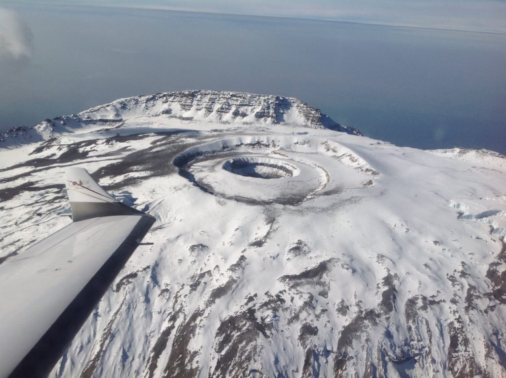
Kibo is the youngest and largest cone on Mount Kilimanjaro with the last volcanic activity dated to as recent as 150,000 – 200,000 year BP (Before the Present) stretching out more than 24km at the Saddle plateau altitude. An almost symmetrical cone caps Kibo with escarpments rising 180 to 200 meters (590 to 660 ft) on the south side. These escarpments define a 2.5km wide (1.6 mi) caldera caused by the collapse of the summit.
Within this caldera is the Inner Cone and within the crater of the Inner Cone is the Reusch Crater named after Gustav Otto Richard Reusch. The Ash Pit, 350m (1,150 ft) deep, lies within the Reusch Crater.
Time to descend back home to rejuvenate and recuperate as you wallow in the memories of what will most certainly be one of the most epic live scenes you will ever experience anywhere else in Africa.
Maps
Deprecated: round(): Passing null to parameter #1 ($num) of type int|float is deprecated in /home/nisimulieafrica/public_html/wp-content/themes/goto/framework-customizations/extensions/feedback/views/reviews.php on line 8

